

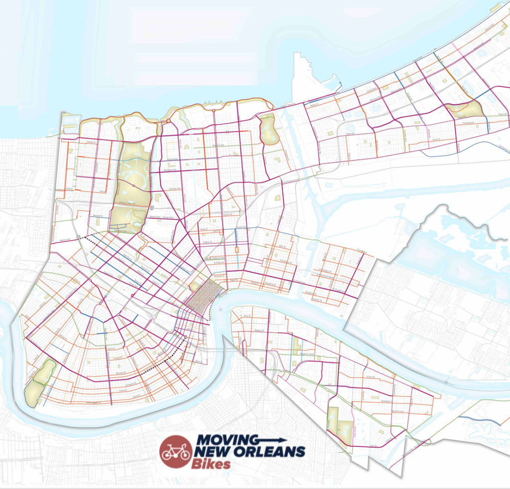
Moving New Orleans Bikes is a central initiative of Mayor Cantrell’s overall transportation plan called Moving New Orleans. Moving New Orleans Bikes began with the creation of an official city-wide vision for a connected network of low-stress bikeways and walkways reaching every corner of Orleans Parish, encompassing more than 600 miles of new routes.
Visit the City of New Orleans official site for ‘Moving New Orleans Bikes’
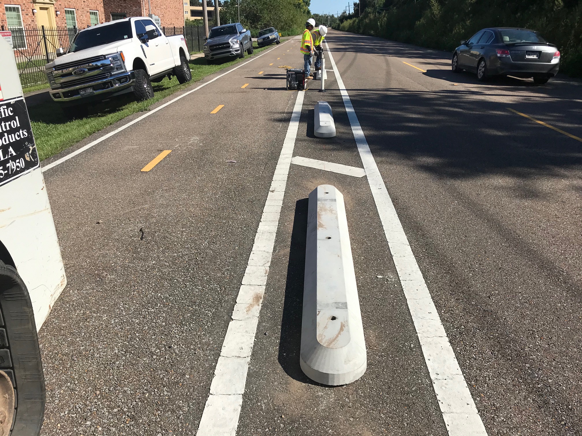
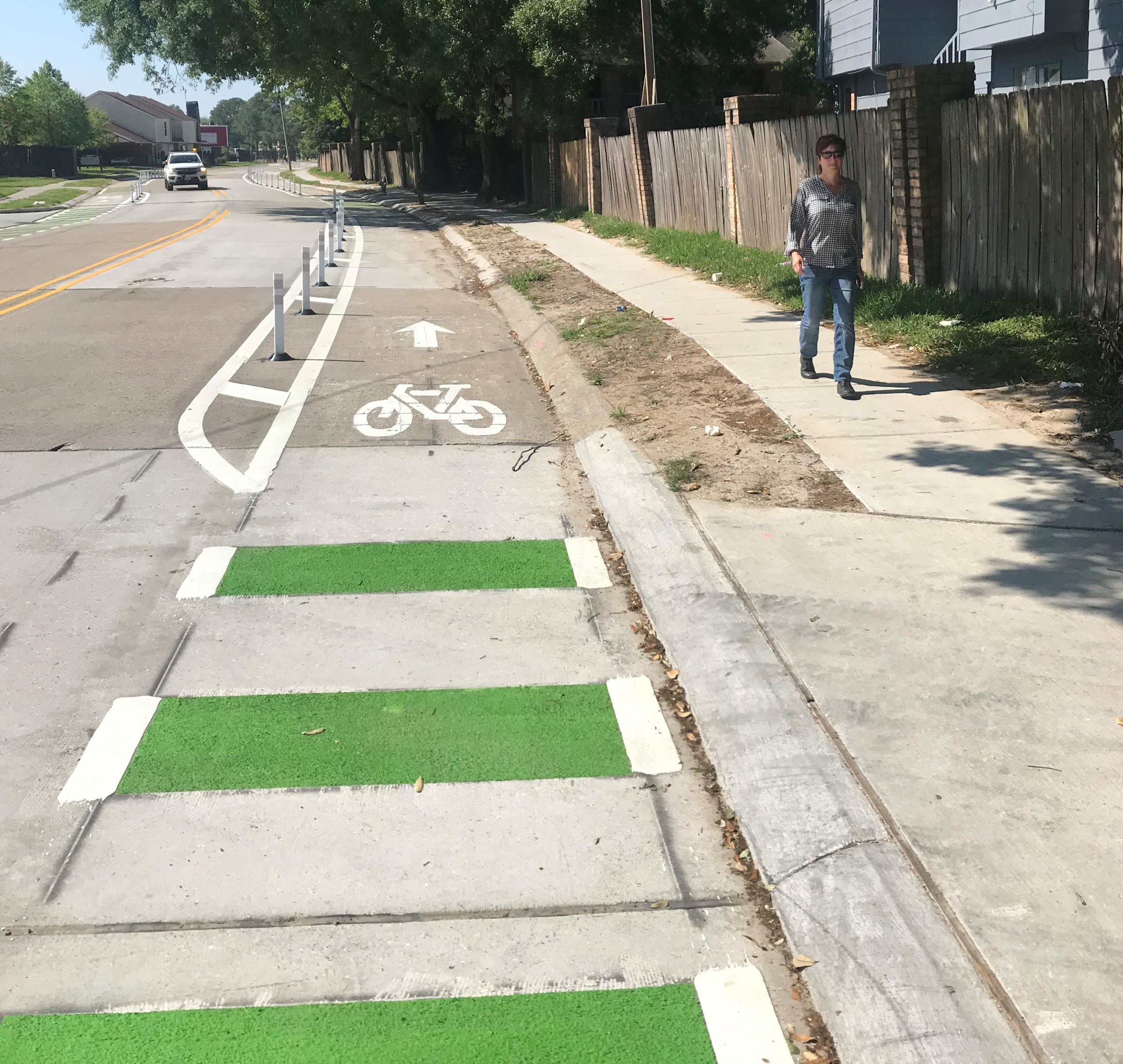
During this first year of construction, the City of New Orleans is committed to building the first 75 miles of improvements including protected bike lanes, bike/walk boulevards, high-visibility crosswalks, improved bus stops and bus islands, refurbished sidewalks, and more. These first 75 miles will be focused in Algiers and neighborhoods directly adjacent to downtown New Orleans.
Check out one of our neighborhood resource pages for information about ‘Moving New Orleans Bikes’ improvements in your neighborhood:
(More coming soon!)
The improvements which comprise Moving New Orleans Bikes will ensure everyone — people walking, biking, driving, or riding public transit — have safe access to their fair share of the road. Central to the goals described in the Moving New Orleans vision is a city where all residents can safely, easily, and affordably commute to work, visit friends, exercise, go to the store, or access healthcare and do so no matter how they move from point A to point B.
This low-stress bikeway network will have numerous benefits for residents, families, and New Orleans communities: better job access, health benefits, reduced demand for parking, and a general improved quality of life.
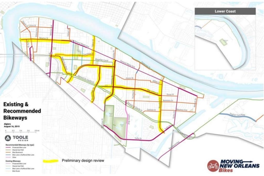
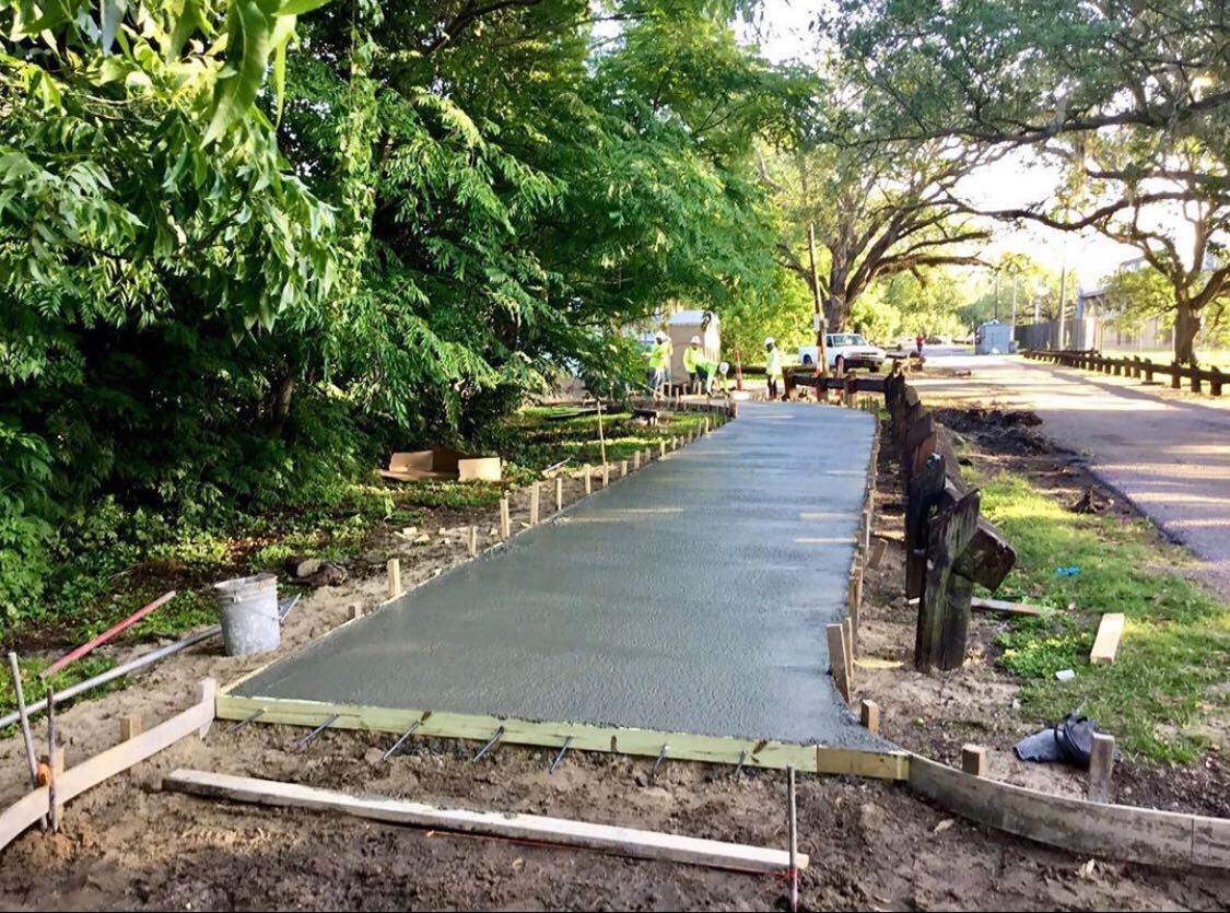
Algiers
Algiers is receiving the first 11 miles of low-stress bikeways along 11 corridors.
These corridors will connect residents to local businesses, grocery stores, schools, as well as biking and nature trails.
Construction is expected to be finished in the fall of 2020.
As these Complete Streets are built, people are already activating them. From planting trees along Newton Street, to family bike rides across Algiers, you can learn more about them on our Complete Streets Activation Mini Grant page.
Public Meetings
To engage and inform the Algiers community, as well as gain feedback on the their plans for improving street safety, the City of New Orleans held public meetings on improvements coming to Upper and Lower Algiers.
The presentations contain detailed descriptions and diagrams of how the City if bringing more safety and less stress to streets in Algiers.
Click here to download the presentation for improvements in Upper Algiers.
Click here to download the presentation for improvements in Low Algiers.
For details on the City’s public meetings, visit their Moving New Orleans Bikes website.

Corridors and Fact Sheets
- Garden Oaks Dr (Old Behrman Hwy to Gen de Gaulle Dr)
- Holiday Dr (Behrman Place to General Meyer Ave)
- Lawrence St (Hendee St to Odeon St)
- MacArthur Blvd (General de Gaulle Dr to Woodland Dr)
- Mardi Gras Blvd & Florence Dr (L.B. Landry Ave to Old Behrman Hwy)
- Newton St (Mississippi River Trail to Behrman Ave)
- Odeon St (Wall Blvd to Patterson Dr)
- Wall Blvd (General de Gaulle Dr to Holiday Dr)
- Westbend Pkwy (General de Gaulle Dr to Wall Blvd)
- Woodland Dr (Tullis Dr to General Meyer)

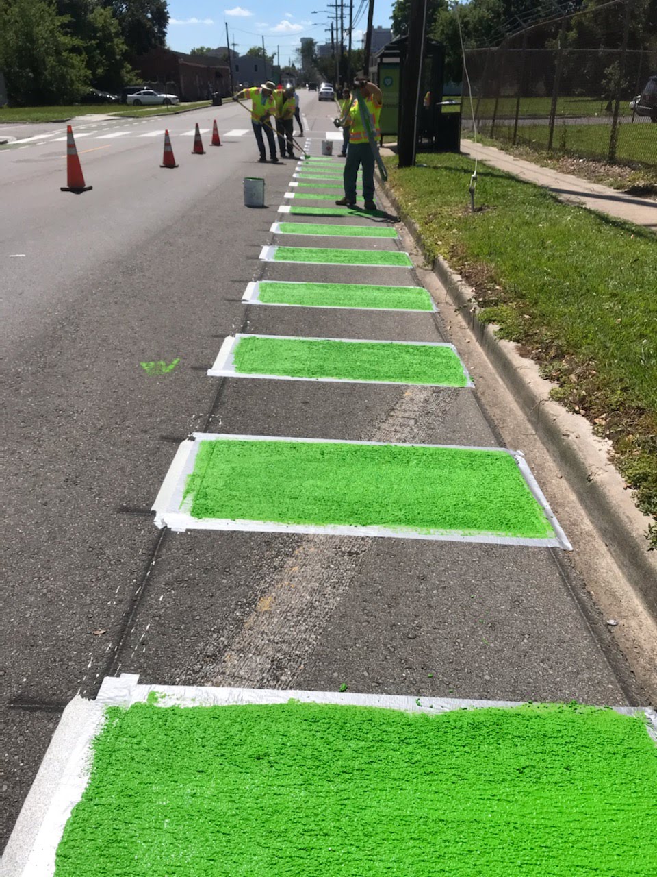
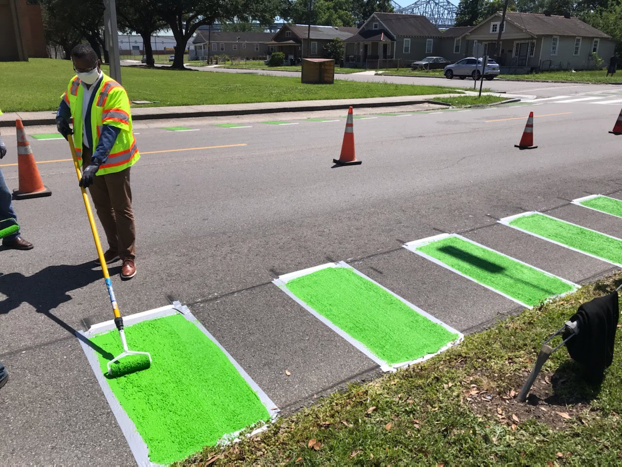
Marigny and French Quarter
As part of the Moving New Orleans Bikes Plan, 1.72 miles of streets in the Marigny and edge of the French Quarter are receiving safety infrastructure improvements, including protected bike lanes, extended curbs, improved crosswalks, repaved streets, and more.
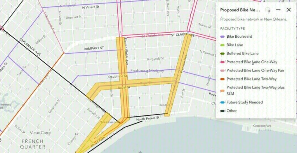
These improvements are being implemented along 5 corridors: Franklin Avenue, Royal Street, Elysian Fields Avenue, Decatur Street, and N. Peters Street. The City of New Orleans has already presented design plans, received and implemented feedback from the community, and is finishing construction. You can see photos below.
Public Meetings
Over the Summer of 2020, the City of New Orleans held public, virtual meetings to present and receive feedback on their plans for street safety improvements in the Marigny and edge of the French Quarter.
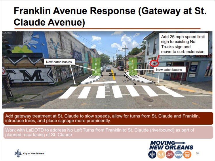
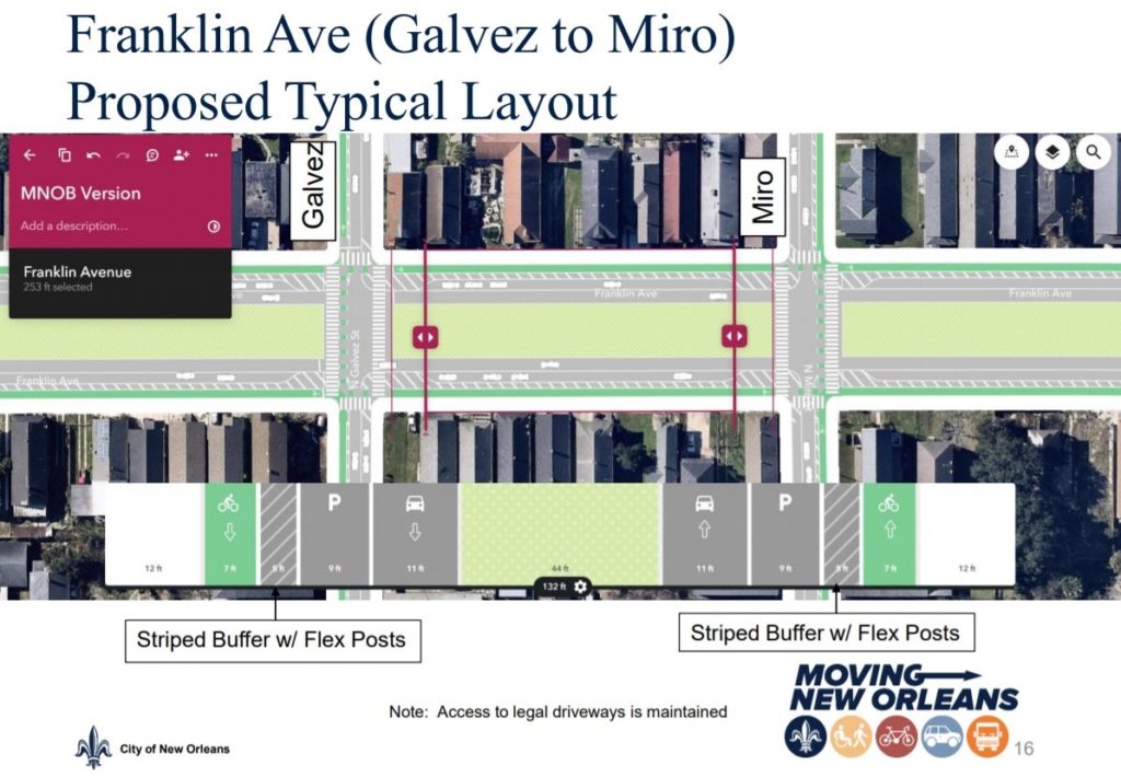
At the meetings, City officials listened to and incorporated community input into their plans. For example, the diagram to the right shows an added gateway to Franklin Ave. that came after community members asked for traffic calming measures on this street.
You can learn more about how the City of New Orleans conducted their community engagement process by reading our blog post here.
Corridors and Factsheets
- Decatur Street (Esplanade Avenue to Dumaine Street)
- Elysian Fields Avenue (N. Peters Street to St. Claude Avenue)
- Franklin Avenue (N. Peters Street to St. Claude Avenue)
- N. Peters Street (Dumaine Street to Elysian Fields Avenue)
- Royal Street (Esplanade Avenue to Franklin Avenue)


Central City
Central City and parts of the Lower Garden District will receive 2.78 miles as part of the Moving New Orleans Bikes plan. These improvements range from parking protected bike lanes, to road repaving, green infrastructure and more.
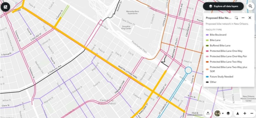
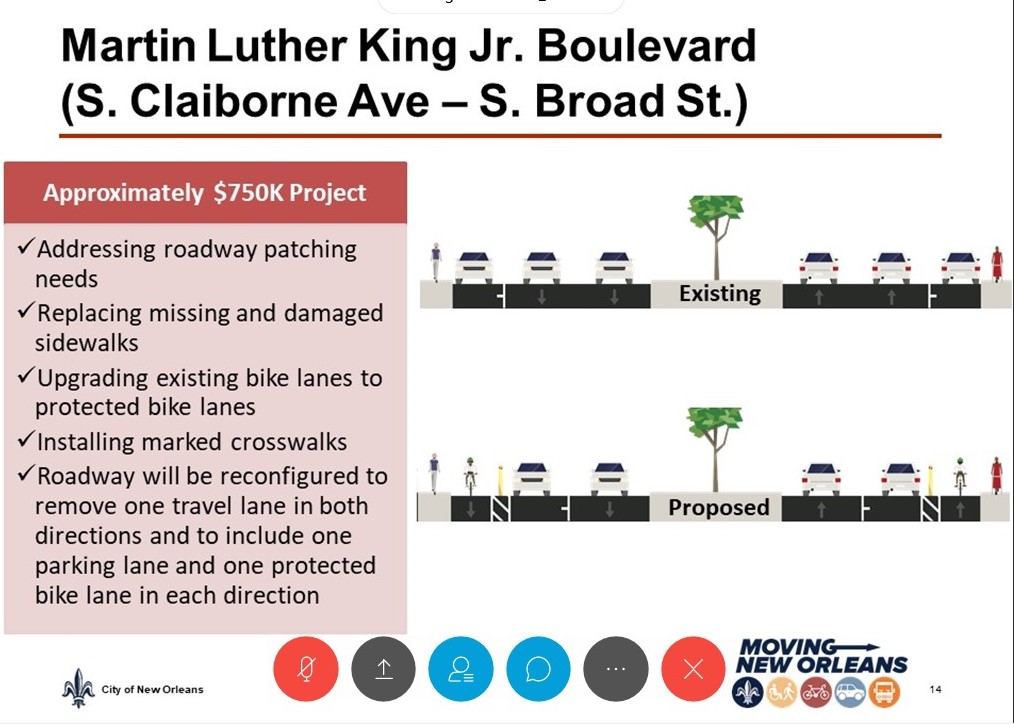
The improvements will happen over 5 corridors: Baronne Street, Martin Luther King Jr. Boulevard, Melpomeme Street, S. Broad Street, and S. Galvez street. Construction is expected to begin in the beginning of 2021.
Public Meetings
The City of New Orleans held a public pre-construction meeting on street safety improvements coming to Central City in July. At the meeting, officials from the City presented information about the current conditions of the area’s streets, and their plans to bring more safety and less stress to Central City’s streets. They also answered questions from the community and received feedback on their plans. We expect them to hold another public design meeting and address the community’s feedback soon.
Corridors and Factsheets
- Baronne Street (Calliope Street to Phillip Street)
- Martin Luther King Jr. Boulevard (St. Charles Avenue to S. Broad Street)
- Melpomene Street (St. Charles Avenue to Camp Street)
- S. Broad Street (Eve Street to Martin Luther King Jr. Boulevard)
- S. Galvez Street (Martin Luther King Jr. Boulevard to Erato Street)
Central Business District
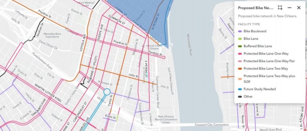
The Central Business District is a main thoroughfare for many New Orleans Residents. The City has plans to build protected bike lanes throughout the area, ensuring people can safely commute through the area, all the way to and from Canal Street.
The City of New Orleans is initially focusing on a 1.8 mile corridor in the Central Business District comprising of Baronne Street, O’Keefe Avenue, and Julia Street.
We know from experience that a few, loud voices will push back against these changes. That’s why we’re asking people to tell City officials that we support Complete Streets in the CBD. Sign our petition by clicking here today.
Public Meetings
Officials from the City of New Orleans’ Office of Transportation, Moving New Orleans, held a community design meeting for street safety improvements coming to the Central Business District on October 27th, where officials presented their plans and the community offered feedback on their proposals. You can view the slides from the presentation and review the proposed designs by clicking here.
On Thursday February 25th, City officials held a pre-construction meeting where they presented their final plans to build Complete Streets in the CBD, and responded to community feedback on their previous plans. You can view the slides from the presentation and the final design plans by clicking here.
One more pre-construction meeting to discuss improvements coming to Julia Street is currently being planned though there’s no date yet.
Here are the streets that were discussed in the meetings:
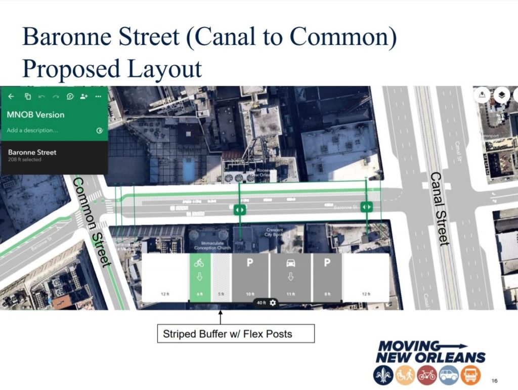
- Baronne Street (Canal Street to Howard Avenue)
- Howard Avenue (St. Charles Avenue to Loyola Avenue)
- Julia Street (Carondelet Street to Loyola Avenue)
- O’Keefe Avenue (Howard Avenue to Canal Street)
7th Ward and Downriver
Public Meetings
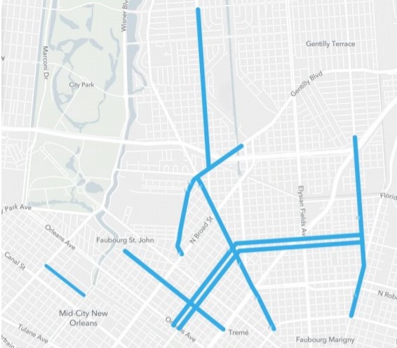
The 7th Ward and Downriver neighborhoods such as Faubourg St. John, St. Roch, Gentilly, and Mid-City are going to see miles of protected bike lanes and other street safety improvements such as extended curbs, improved signage, and roadway repairs.
Read more about the City’s proposed plans in our blog post by clicking here.
Officials from the City of New Orleans held a conceptual design meeting to present their proposed plans for street safety and accessibility improvements on Tuesday, November 17th 2019.
You can view the slides from the community design meeting presentation by clicking here.
On Tuesday February 23rd, officials from the City helda pre-construction meeting where they presented their final plans to build Complete Streets in the 7th Ward areas, and responded to community feedback on their previous plans. You can view the slides from the presentation and the final design plans by clicking here.
There is one more pre-construction planned to discuss improvements coming to Franklin Avenue and St. Bernard Avenue, though a date has not yet been set.
Here are the corridors that were discussed:
- Bienville Street (N. Jefferson Davis Parkway to N. Carrollton Avenue)
- Franklin Avenue (St. Claude Avenue to I-610)
- Gentilly Blvd (N. Broad Street to New Orleans Street)
- N. Galvez Street (Orleans Avenue to Franklin Avenue)
- N. Miro Street (Franklin Avenue to Orleans Avenue)
- Paris Avenue (I-610 to Filmore Avenue)
- St. Bernard Avenue (N. Rampart Street to Gentilly Blvd)
- Ursulines Avenue (N. Claiborne Avenue to Hagan Avenue)
Timeline
When Mayor LaToya Cantrell was first sworn in, she made transportation a priority for her administration and established the Mayor’s Office of Transportation. Since then, the Office of Transportation has supported efforts to make transportation more accessible and equitable in New Orleans, including the Moving New Orleans Bikes Plan.
Starting in April 2019, the Office of Transportation embarked on a city-wide bike planning effort to create a completely connected and safer system of bike lanes that allows people on bikes to get to where they’re going safer and easier. The City held public meetings to gain input on the existing network and to hear what residents’ needed and wanted from their bikeway network.
That Summer, City officials presented the collected input and introduced the draft bikeway network map in a series of public meetings across New Orleans. Building off of previous input and collecting more feedback on the draft bikeway network map, the City then launched into a rapid design and build-out of the bikeway network.